Salmo Radar About Open the map

The fishing map that answers WHERE, WHEN and HOW.

Pick a date. See in one view where the best conditions are. Index takes into account reach-specific flows, temperature, salmon and steelhead run timing, hatches and fresh shop reports.

Open the map

Free. Install it on your phone.

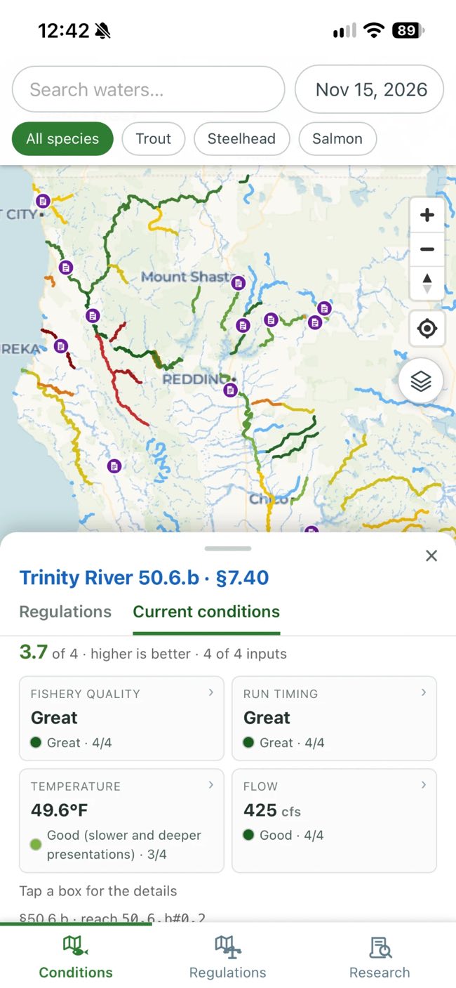
The app on a phone: northern California with rivers coloured by condition, and a panel for the Trinity River scoring 3.7 of 4 — fishery quality and run timing great, water at 49.6 degrees, flow 425 cubic feet per second.

When & Where

Regulations drawn ON the map

Every section of the rulebook transcribed and traced onto the regulated water. Not a pin on a river's name: the line stops where the rule says it stops, at a dam, a bridge, a confluence. District general regulations overlaid on the map to display rules outside of special regulated waters and exceptions.

Tap it and you get the water the rule describes, the season, the daily bag and whether it is open today.

For information only, not legal advice. Always check the official CDFW regulations before fishing.
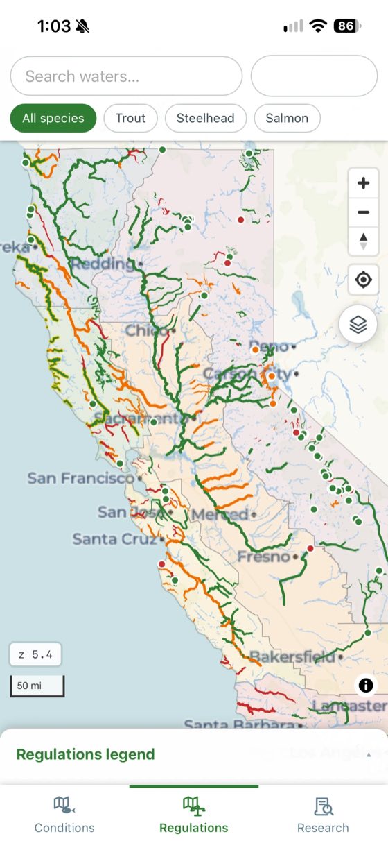
The whole of California with its rivers coloured green where fishing is open, orange where it is closed on the chosen date and red where it is closed all year.
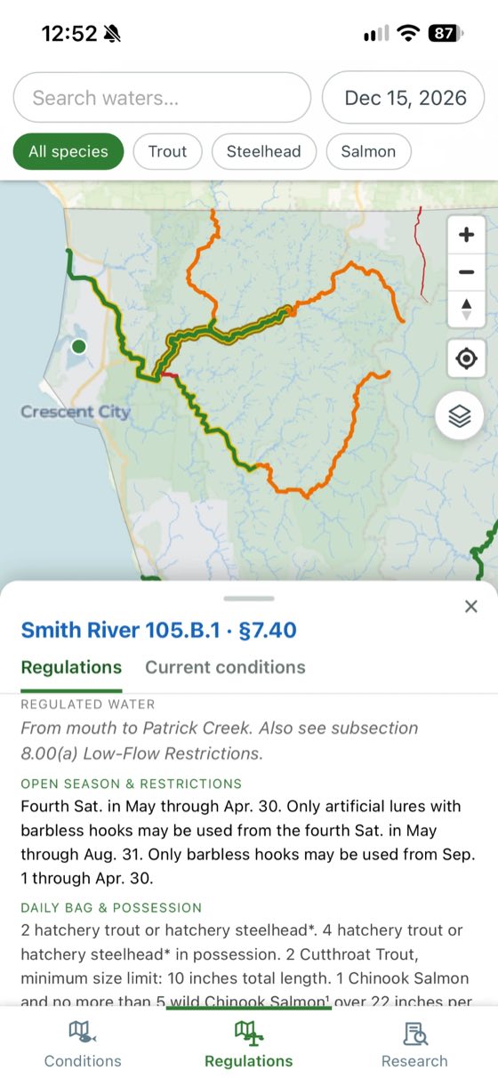
The Smith River picked out on the map from its mouth to Patrick Creek, with a panel below giving that regulated water, the open season and barbless-hook restrictions, and the daily bag.

When

Reach SPECIFIC Flows and Temperatures

Each reach gets its own bands — blown out, high, good, low — set where the fishing changes, not where today's number sits against history.

Flow and water temperature come from USGS and NOAA gauges, matched to the stretch of river they actually measure — not to a river's name.
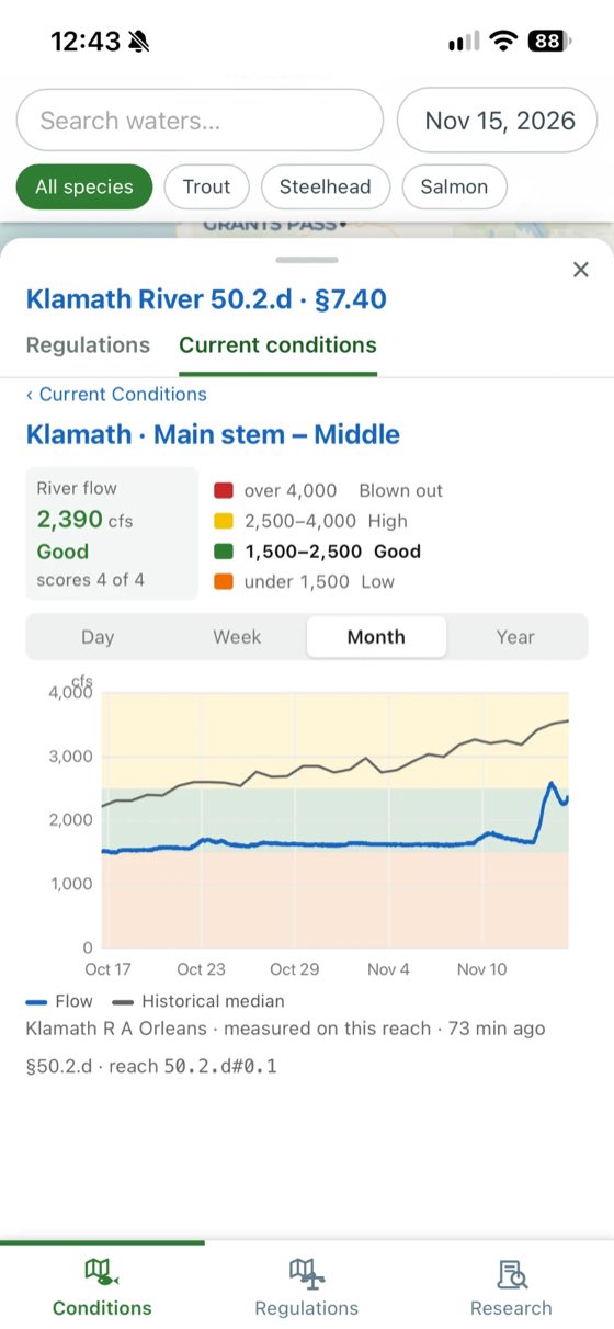
River flow for the Klamath: 2,390 cubic feet per second, rated good, with the bands for blown out, high, good and low, and a month of readings charted against the historical median.
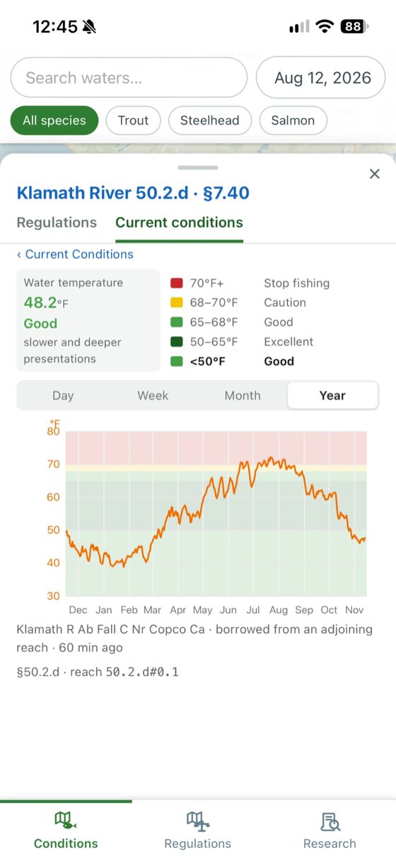
Water temperature for the Klamath: 48.2 degrees, rated good, with the thresholds from excellent down to stop fishing, and a year of readings charted against them.

When & How

Run Timing and Hatches

A month-by-month picture for every mapped river: when a run arrives, peaks, holds and spawns, whether it is wild or hatchery-supported, and how much conservation concern it carries.

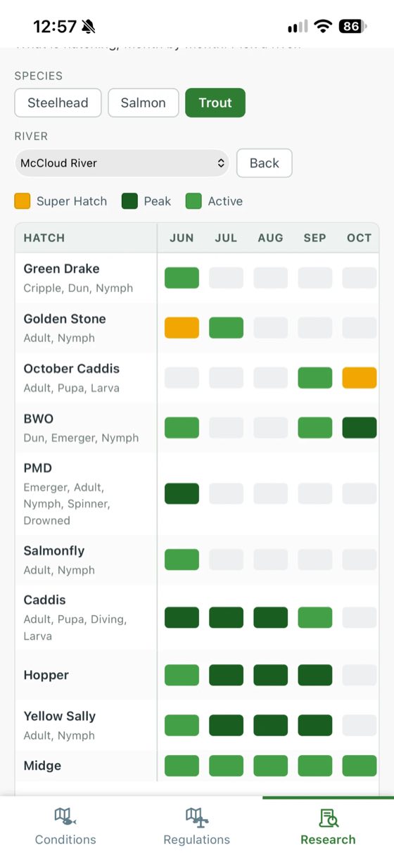
Switch to trout to see a hatch calendar. Pick a river and you get its hatches month by month — green drake, salmonfly, October caddis — graded active, peak or super hatch, each with recommended patterns.
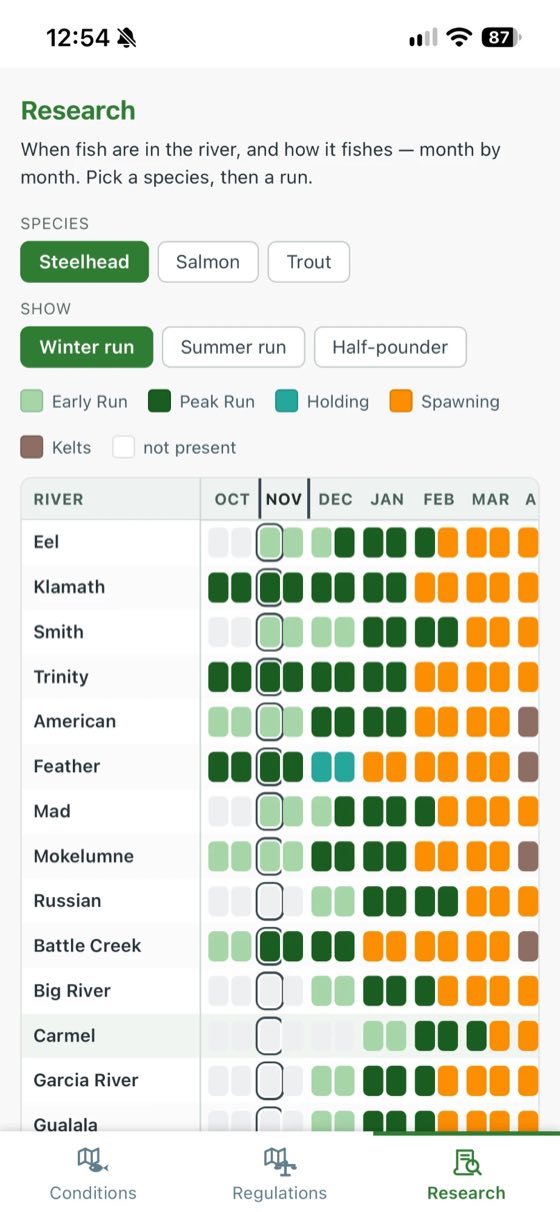
A table of rivers against months for winter-run steelhead, each month shaded for early run, peak run, holding, spawning or kelts, with the current month outlined down the column.
The hatch calendar for the McCloud River: green drake, golden stone, October caddis, BWO, PMD, salmonfly, caddis, hopper, yellow sally and midge against the months, graded active, peak or super hatch, each with the stages worth fishing.

Who says so

Reports

Fishing reports published by guides and shops, pinned to the water they are about. Each links back to the author, so you can book a guide, ask for local intel or pick up what you need.
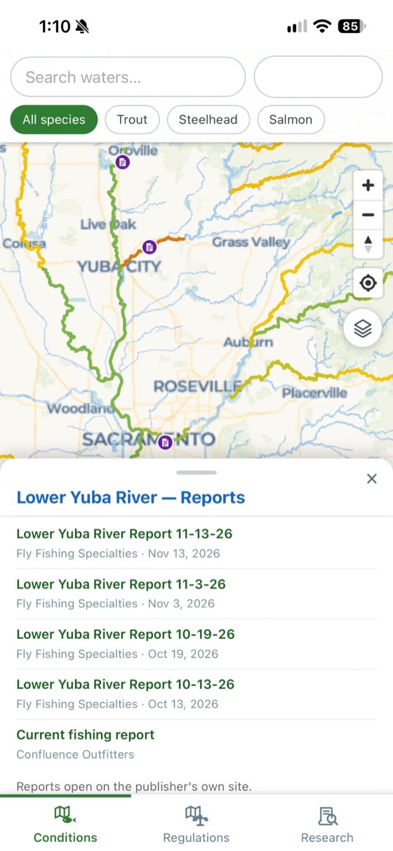
Report markers along the rivers, and a panel listing five reports for the Lower Yuba River from Fly Fishing Specialties and Confluence Outfitters, each with its date, noting that reports open on the publisher's own site.

Also in there

Find out where the bite is on.

Open the map